
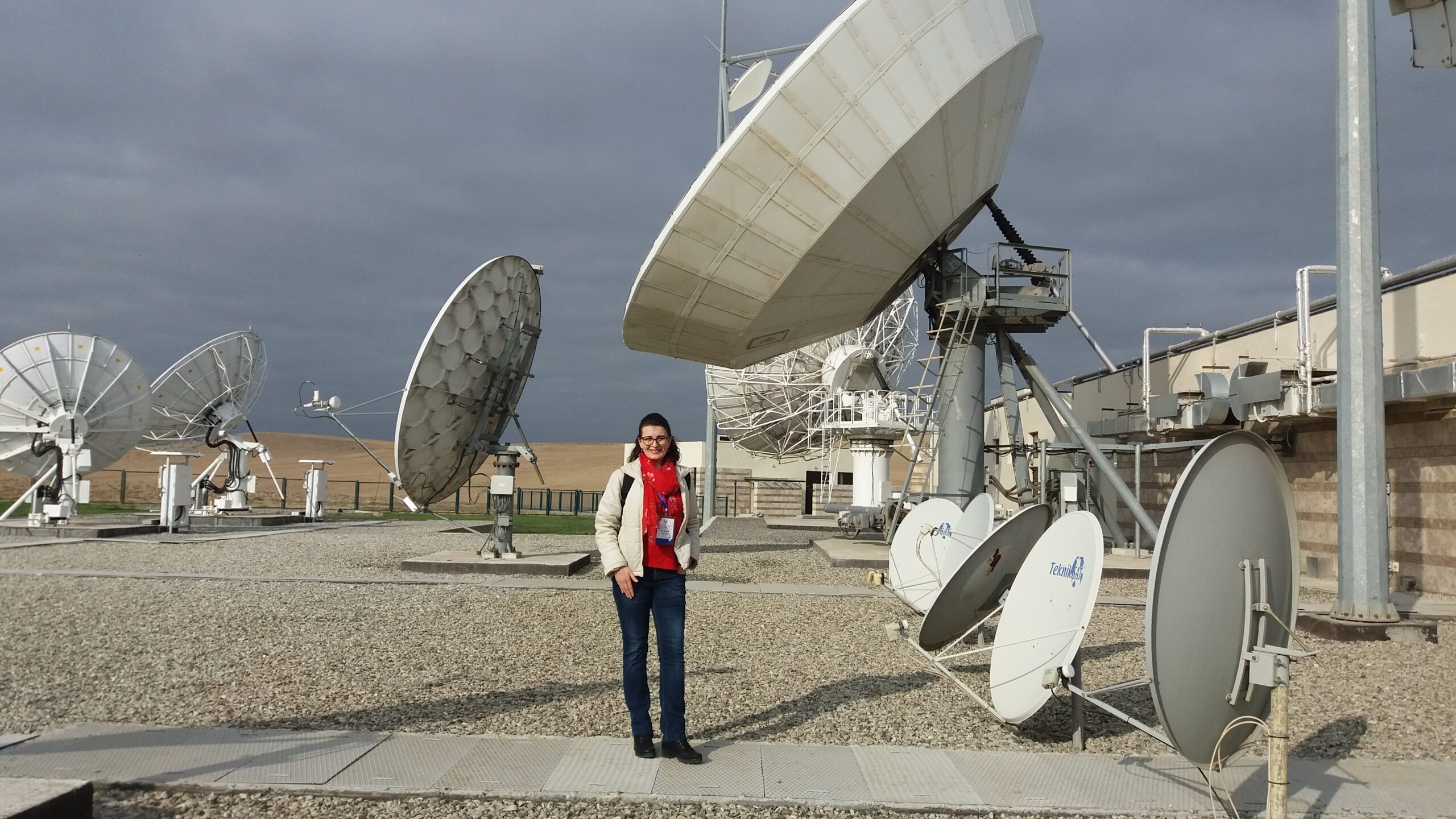
 Graduated engineer of geodesy and a young scientist from Travnik, Randa Natras, is the only scientist in the field of satellite geodesy that represented Bosnia and Herzegovina at an international workshop in Shanghai, as well as in many other world-class scientific events around the world.
Her scientific work is based on the development of the first regional correction model of high resolution and precision for satellite positioning for the territory of Bosnia and Herzegovina. The model was developed to minimize the impact of the Earth’s upper atmosphere on the propagation of the satellite signal, which is the most dominant source of errors in satellite positioning and navigation. The scientific project was supported by a grant from the Austrian Agency for International Mobility and Cooperation in the field of Education, Science and Research (OeAD) and was carried out at the University of Technology Vienna for a period of 9 months.
The results of the project were presented at world-class scientific events such as the European Geosciences Union General Assembly in Vienna, the Summit on Space Geodesy in Berlin, the International workshop at the Astronomical Observatory in Shanghai, while the first scientific research of the upper atmosphere over the B&H using observations of navigation satellite systems was carried out as part of Randa’s master thesis and presented at the Scientific assembly in Japan.
For additional education, Randa attended the school “Space Weather and Global Navigation Satellite Systems” of the International Space Weather Initiative, where lecturers were eminent world-class experts from NASA, the Boston College, the International Center for Theoretical Physics, the University of Sorbonne, and others.
This young scientist received her Master’s degree from the University of Sarajevo with the distinction “Charter of the University” as the best student of the first and second cycle of studies at the Faculty of Civil Engineering. In the global recognition of the American Geospatial magazine xyHt she has been recognized as an outstanding geospatial expert under 40 years of age.
The following scientific plans are the expansion of this correction model to the Western Balkans region, supported by the research grant of the German Academic Exchange Service (DAAD) in 2019.


