
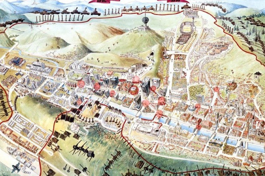
 Map of the siege of Sarajevo is part of the exhibition “Maps that marked the 20th century”, which was opened on the 4th of November in the British Library in London.
Exhibited maps shed new light on the well-known events, conflicts, creativity, the ocean floor, and even the universe. By telling the history of the 20th century, they are forcing us to look at the recent past from different perspectives and sharpen our way of looking at the world in which we live.
The new setting is celebrating rare beauty and astonishing diversity of maps of the 20th century. From the first drawing of the London Underground in 1931, through a map of the British Ministry of Defense to the map of the siege of Sarajevo.
Map of the siege of Sarajevo contains all the details of survival with a description of function of facilities that were of great importance for every city. It shows secret passages, tunnels, special corridors for the movement of the city that were invented in order to be saved from a full day of sniper fire.
This shows that the city parks were replaced with gardens, roses with corn, electrical with medieval lamps, heating stoves with handmade ones, water from the tap with the water that was poured only in certain places and then transferred by canisters, recreation with running under sniper fire, calorie food with plants from your own garden, television with live interviews, and turned art into a resistance to terrorists.
(Source: klix.ba)


